Territorial landslide early warning systems (Te-LEWS)

EU2-Campania region, Italy
Hydro-geological risk management in the Campania region follows the rules set by the Decree of the President of the Regional Council of Campania (D.P.G.R.) No 299 of June 30, 2005, which is titled: "Il Sistema di Allertamento Regionale per il rischio idrogeologico e idraulico ai fini di protezione civile. Ruoli e compiti delle strutture regionali di protezione civile nell’ambito delle procedure di previsione e prevenzione del rischio idrogeologico per il territorio regionale".
1 The setting
In Campania, the Regional Functional Centre for weather forecasts and monitoring of meteorological and hydrogeological issues is included in the “Settore Programmazione Interventi” of the Campania Region, located in Naples. The Functional Centre undertook research and study activities aiming at designing an early warning system to employ in the Campania region as part of a regional hydrogeological risk mitigation strategy. The duty of this Centre is therefore to concentrate and handle a series of data with the purpose of providing a continuous service throughout the year, working 24/7 when appropriate, in order to assist authorities responsible for warnings issuing and emergency management. To pursue its tasks, the Functional Centre gathers information from several offices, such as: Ufficio Generale dell’Aeronautica Militare (UGM), Servizio Meteoidrologico Regionale (SMR), Agenzia Regionale per la Protezione Ambientale (ARPA) Emilia Romagna, a Regional Competence Centre for Analysis and Monitoring of Environmental Risks (AMRA). It is organized into three main areas, physically and logistically integrated.
The first area is dedicated to the collection, validation, processing and storage of the data collected in the Campania region by networks of detection and monitoring of weather-hydropluviometric parameters. Data and information gathered by the Functional Centre can be classified into two main categories: meteorological data, used and processed for weather forecast, report and warning issuing; weather-hydropluviometric data detected by the monitoring networks in real time, used and processed for the possible occurrence of dangerous hydrogeological and hydraulic events. The second area of the Centre is dedicated to the interpretation and integrated use of the data and information produced by the forecast model and, for providing full support to Civil Defence authorities for the issuing of warnings. Moreover, this area deals with the forecasting, monitoring and surveillance of meteorological and hydrological events and their effects on the ground. Another duty is the establishment of tools and the definition of how information on the occurrence and evolution of hydrogeological and hydraulic risk must be collected, analyzed and made available to the Unified Regional Operations room (SORU) of the Regional Civil defence area. The activities carried out within this area aim at operating and upgrading the landslide early warning system through the definition of: alert zones and related rainfall thresholds; rainfall precursors and relative threshold values; hydraulic indicators and threshold values. The third area of the Functional Centre deals with the information management in terms of systems ensuring the effectiveness of the communication strategies. In particular, the activities of this area are aimed at optimizing the flow of data and the information available for the prediction of hazardous events and their effects. Summarizing, the Functional Centre provides the following functions:
-
weather forecast:
-
warning levels issuing for civil defence purposes;
-
meteorological, hydrological and landslide monitoring;
-
weather, rainfall and hydraulic modelling;
-
rainfall and hydrometric thresholds definition;
-
programming, design, maintenance and management of monitoring networks.
The service provided by the Functional Centre in real time is carried out through a two-phase wheater forecast and monitoring strategy, implemented in a coordinated and integrated way. The first phase is composed by the meteorological analysis, through numerical modelling, and by the evaluation of the effects of hazardous hydrogeological phenomena in terms of risk to the population, buildings, infrastructures and the environment. The second phase includes: i) the qualitative and quantitative evaluation of meteorological and hydrological events based on monitoring data, ii) hydrological and weather short-term forecasting based on nowcasting technics and rainfall-runoff modelling.
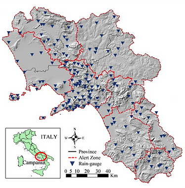
Qualitative and quantitative data are collected from: weather and hydro-pluviometric networks; a national meteorological radar network; various satellite platforms available for earth observation; geological geomorphological and meteorological modelling. The monitored area is approximately 19’200 km2 and includes much of the Campania Region and parts of the neighbouring regions (3’750 Km2 in Lazio, 800 Km2 in Basilicata, 1’200 Km2 in Abruzzo and 950 Km2 in Molise). The existing network of hydro-pluviometric monitoring in real time of the Functional Centre consists of 154 stations with electronic sensors and data transmission, either via tropospheric radio or satellite links. The 154 stations, operating since 2005, are instrumented with the following instruments:
-
128 rain gauges;
-
54 hydrometers;
-
56 thermometers;
-
13 hygrometers (relative atmospheric humidity);
-
5 barometers (atmospheric pressure);
-
4 anemometers (wind speed and direction);
-
4 radiometers (global solar radiation);
-
2 thermometers soil (soil surface temperature);
-
2 hygrometers soil (soil surface moisture);
-
1 wave measurement station.
The data transmission system in real time is constituted by:
-
129 local transceivers in tropospheric radio relay (UHF);
-
25 local transceivers for satellite radio bridge (polar constellation);
-
5 type duplex repeater (including 3 with hot spare);
-
4 repeaters simplex (including 4 with hot spare);
-
9 repeaters half-simplex (including 4 with hot spare);
-
4 Radio frameworks for the control panel (2 main and 2 reserve).
The monitoring stations falling outside the boundaries of the Campania region are 14 (8 in Lazio, 4 in Molise and Basilicata 2) and are instrumented with 10 rainfall sensors (4 in Lazio, 4 in Molise and 2 in Basilicata), 6 temperature sensors (2 in Lazio, 3 in Molise and 1 in Basilicata), and 8 hydrometric sensors (7 in Lazio and 1 in Molise). Pending the establishment of inter-regional agreements, the Campania Region is providing the management of the stations which fall within the Liri-Garigliano Volturno and Sele catchment areas. One of the future objectives of the regional Civil defense is the upgrading and enhancement of the monitoring network, up to a planned network of 350 stations which would include: 320 rainfall sensors, 150 thermometers, 70 hydrometers, 60 hygrometers and 130 more sensors among anemometric, radiometric, barometric, and snow stations.
Weather forecast phase
As defined in the D.P.C.M. 59/2004, an Alert Zone can be seen as a significantly homogeneous area for the expected meteorological and hydrogeological events that may occur within it. The Alert Zones have been introduced specifically and exclusively for the weather forecast phase. The scale of analysis adopted for the Alert Zones is called “mesoscale beta” (40-100 km) because a more detailed scale is not significant for weather forecast purposes, due to the uncertainty of the numerical weather models to forecast the spatial location of heavy rainfalls. The Campania region is divided into 8 Alert Zones (Fig. 12) according to homogeneity criteria which consider the following factors: hydrography, morphology, rainfall, geology, land-use, hydraulic and hydrogeological events, administrative boundaries. The main characteristics of each Alert Zone are reported in terms of: morphology, main river basins, altimetry, rainfall characteristics and main risk scenarios.
During the weather forecast, the amount of rainfall (in mm) provided by LAMI model (http://www.cineca.it/it/content/il-modello-numerico-cosmo) are adopted as precursors of the possible occurrence of hydraulic and hydro-geological critical events. In the D.P.G.R 299/2005 the precursors are defined as "alarm bells" used to issue a certain warning level once they exceed predetermined threshold values. Furthermore, for each Alert Zone two different type of precursors can be defined: precursors of local criticality, adopted for rainfall events with spatial characteristics able to affect only a portion of the Alert Zone; precursors of areal criticality, adopted for rainfall events with spatial characteristics able to affect the whole Alert Zone. The precursors of local criticality are assumed equal to the maximum value of the average height of rainfall forecasted over an area of about 450 km2 (corresponding to 9 points of the model LAMI grid) within each Alert Zone. They are evaluated considering time intervals of 6, 12 and 24 hours. The precursors of areal criticality are assumed equal to the maximum value of the height of rainfall expected over the whole Alert Zone, calculated with mobile windows of 24 hours. Three threshold values have been defined for each group of precursors, per each Alert Zone, identifying three critical conditions: ordinary, moderate and high. The weather forecast and the evaluation of the rainfall amount, in terms of height, is provided to the Functional Centre by different agencies, by means of the following tools and models: ECMWF 12, ECMWF ENSEMBLE, LAMI, LAMI 00 and 12, METEOSAT, NEFODINA, NEFOMEDI, IXEUR, Grazzanise RADAR, LIGHTNING DETECTOR, AIR FORCE CARDS, CARDS MetOffice, radiosonde SEA PRACTICE, Prometheus.
All these tools and models provide meteorological data and information which are needed to: the Regional Meteorological Bulletin, notifications of Adverse Weather Conditions, forecasting of short-term events to evaluate conditions of criticality. The Functional Centre transmits the Regional Meteorological Bulletin, for civil defence purposes, to the Unified Regional Operations Room of the Civil defence (SORU), which forwards it to local and regional authorities. The Functional Centre, considers the Meteorological Daily Bulletin issued by the Department of Civil defence, its Regional Meteorological Bulletin and, eventually, other additional information to issue a Regional Notice of Adverse Weather Conditions whenever there is the possibility of occurrence of critical conditions due to heavy meteorological events (rainfalls, wind, temperature variations, rough sea). If the meteorological events refer to rainfall, a Regional Notice of Adverse Weather Conditions for hydrogeological and hydraulic risks is issued. With the issuance of the Notice of Adverse Weather Conditions, the Functional Centre states the possible level of criticality, the type of events, the risk scenarios expected. The Notice of Adverse Weather Conditions is issued normally by 14:00 and has minimum validity of 24 hours.
In general, the level of criticality for each Alert Zone is established taking into account the results of the meteorological analysis and the thresholds exceedance of precursors of criticality. The level of criticality ORDINARY is issued, in an Alert Zone, if the following conditions exist: the Notice of Adverse Weather Conditions predicts significant rainfall events for the following 24 hours; based on the results of LAMI model, one of the precursors of criticality exceed the threshold value corresponding to the ordinary condition criticality. The level of MODERATE is issued, in an Alert Zone, if the following conditions exist: the Notice of Adverse Weather Conditions predicts heavy rainfall events; based on the results of LAMI model, one of the precursors of criticality exceed the threshold value corresponding to the moderate condition criticality. The level of HIGH is issued, in an Alert Zone, if the following conditions exist: the Notice of Adverse Weather Conditions predicts heavy rainfall events; based on the results of LAMI model, one of the precursors of criticality exceed the threshold value corresponding to the high condition of criticality..
Monitoring phase
In Campania hydraulic and hydrogeological events induced by heavy rainfall typically refer to debris flows, earth flows in pyroclastic soils (Varnes 1978), shallow landslides, hyper-concentrated flows (Coussot and Meunier 1996), floods, localized floods for embankment failures, erosion by overland flow.
The D.P.G.R. n. 299/05 differentiates among six classes of critical rainfall events, by considering the characteristics of the hydrographical basins as follows:
-
heavy rainfall events in time intervals of 0-6 hours that can generate an hydraulic crisis in basins having areas smaller than 100 km2 (including urban drainage areas);
-
II. heavy rainfall events in time intervals lasting 3-12 hours, which can generate an hydraulic crisis in basins having areas between 100 km2 and 500 km2;
-
III. heavy rainfall events in time intervals lasting 6-24 hours, which can generate an hydraulic crisis in basins having areas from 500 km2 to 2000 km2
-
IV. heavy rainfall events in time intervals lasting 12-48 hours, which can generate an hydraulic crisis in basins having areas between 2’000 km2 and 5’000 km2;
-
V. heavy rainfall events in time intervals of 24-48 hours, which can generate an hydraulical crisis in proximity of the mouth of the Volturno river (catchment larger than 5’000 km2);
-
VI. heavy rainfall events in time intervals lasting 24-72 hours, considered as critical for the occurrence of shallow landslides and debris flows.
Taking into account the previous classification, for each Municipality one or more classes of risk in relation to the type of rainfall event can be defined:
-
Class I. municipalities with hydraulic risk territories included in catchments whose size is smaller than 100 km2;
-
Class II. municipalities with hydraulic risk territories included in catchments whose size is between 100 and 500 km2;
-
Class III. municipalities with hydraulic risk territories included in catchments whose size is between 500 and 2,000 km2;
-
Class IV. municipalities with hydraulic risk territories included in catchments whose size is between 2000 and 5000 km2;
-
Class V. municipalities with hydraulic risk territories included in catchments whose size is larger than 5000 km2;
-
Class VI. municipalities with territories at risk for the occurrence of fast slope movements.
All municipalities belong to class I, which means that they can potentially experience a crisis situation for a flood in a small basin (including urban catchment). The classes II, III, IV and V have been assigned to municipalities with areas at risk included in catchments bigger than 100 km2. The class VI, the only class of interest for this research, includes 212 municipalities of the Campania region deemed susceptible to fast slope movements after the disastrous landslides which occurred in Sarno in 1998 (Cascini 2004) plus municipalities in hilly and mountainous areas for which at least one landslide has been recorded in the AVI database CNR-GNDCI. An Annex to D.P.G.R. 299/2005 reports a table assigning the class of risk per each Municipality of the Campania region as shown in figure 4.9.
Rainfall precursors are, also in this phase, distinguished in local and areal precursors. Local precursors are defined as the heights of rainfall measured individually by each pluviometer. While the areal precursors are defined as the average heights of rainfall calculated in the catchment, as measured by several rain gauges of the monitoring network. For each risk class the following rainfall precursors have been considered:
-
Class I: local precursors at time intervals of 1, 3, 6 hours;
-
Class II: areal precursors at time intervals of 3, 6, 12 hours;
-
Class III: areal precursors at time intervals of 6, 12, 24 hours;
-
Class IV: areal precursors at time intervals of 12, 24, 48 hours;
-
Class V: areal precursors at time intervals of 24, 48 hours;
-
Class VI: local precursors at time intervals of 24, 48, 72 hours;
For each type of rainfall precursor and time interval, threshold values have been obtained from statistical analysis on available historical rainfall series. For each Municipality, belonging to risk class I and VI, a single pluviometer has been chosen as reference and its height of rainfall used as local precursor. On the contrary for each Municipality of classes II, III, IV, V a reference catchment has been assigned and the mean height of rainfall over the carchment is used as areal precursor. Independently of the type and time interval of the rainfall precursor, three different threshold values have been determined based on the following return periods of rainfall: 2, 5, 10 years. The three different values obtained for each type of precursor correspond to three levels of warning for hydrogeological and/or hydraulic risk assigned, for each municipality of the Campania Region, as follows: attention, pre-alarm, alarm. In particular, the attention level is activated when the rainfall precursors exceed the threshold value corresponding to a return period of 2 years. The attention level is also issued by regional Civil defence on the basis of Notice of Criticalities emitted by the Functional Centre with if "moderate" or "high" critical conditions exist in at least one of the 8 alert zones. Pre-alarm status for hydrogeological risk is activated only as a function of rainfall precursors and in particular, if they exceed the pre-alarm threshold values (return period of 5 years). Finally, the Alarm level for hydrogeological risk is activated if rainfall precursors exceed the alarm threshold values corresponding to a return period of 10 years.
Rainfall precursors are, also in this phase, distinguished in local and areal precursors. Local precursors are defined as the heights of rainfall measured individually by each pluviometer. While the areal precursors are defined as the average heights of rainfall calculated in the catchment, as measured by several rain gauges of the monitoring network. For each risk class the following rainfall precursors have been considered:
-
Class I: local precursors at time intervals of 1, 3, 6 hours;
-
Class II: areal precursors at time intervals of 3, 6, 12 hours;
-
Class III: areal precursors at time intervals of 6, 12, 24 hours;
-
Class IV: areal precursors at time intervals of 12, 24, 48 hours;
-
Class V: areal precursors at time intervals of 24, 48 hours;
-
Class VI: local precursors at time intervals of 24, 48, 72 hours;
For each type of rainfall precursor and time interval, threshold values have been obtained from statistical analysis on available historical rainfall series. For each Municipality, belonging to risk class I and VI, a single pluviometer has been chosen as reference and its height of rainfall used as local precursor. On the contrary for each Municipality of classes II, III, IV, V a reference catchment has been assigned and the mean height of rainfall over the catchment is used as areal precursor. Independently of the type and time interval of the rainfall precursor, three different threshold values have been determined based on the following return periods of rainfall: 2, 5, 10 years. The three different values obtained for each type of precursor correspond to three levels of warning for hydrogeological and/or hydraulic risk assigned, for each municipality of the Campania Region, as follows: attention, pre-alarm, alarm. In particular, the attention level is activated when the rainfall precursors exceed the threshold value corresponding to a return period of 2 years. The attention level is also issued by regional Civil defence on the basis of Notice of Criticalities emitted by the Functional Centre with if "moderate" or "high" critical conditions exist in at least one of the 8 alert zones. Pre-alarm status for hydrogeological risk is activated only as a function of rainfall precursors and in particular, if they exceed the pre-alarm threshold values (return period of 5 years). Finally, the Alarm level for hydrogeological risk is activated if rainfall precursors exceed the alarm threshold values corresponding to a return period of 10 years.
1 The modelling
Six hydrogeological and hydraulic classes of risk are identified in the system at municipal level, each one associated to critical rainfall events of different duration. Among these classes, only the risk class named VI refers to landslide risk, in particular to the possible occurrence of fast slope movements; the other classes deal with hydraulic risks. To risk class VI are associated local precursors evaluated considering the cumulated rainfall at intervals of 24, 48 and 72 hours. The threshold values selected for the activation of the warning states of attention, pre-alarm and alarm, have been estimated considering reference return periods equal to 2, 5 and 10 years, respectively. The rainfall thresholds of the warning model have been estimated for each pluviometer on the basis of statistical analyses on historical records of rainfall. Given the maximum annual rainfall aggregate at an assigned duration, X, its value XT related to the return period T, is defined by the following relationship:
XT=KTm(X) (Eq. 2)
where: KT is a probabilistic growth factor, function of the return period T; m(X) is the average value of the distribution of the variable X.
The decisional algorithm therefore includes three rainfall thresholds (cumulated rainfall at 24, 48 and 72 hours) evaluated for three return periods (2, 5, 10 years) for each pluviometer. The thresholds, if exceeded, activate one of the three warning levels defined for the early warning system: attention, pre-alarm, alarm. Each municipality has a set of rainfall thresholds, which depend on the pluviometer to which they are associated.
2 The warning strategy
The response of the regional civil protection on the territory of the Campania region is implemented through the following 3 alert levels for the hydrogeological and/or hydraulic risk: attention, warning, alarm. The attention level is issued by the Settore di Programmazione Interventi of the Civil Protection Agency when the level of criticality is "moderate" or "high" in at least one of the 8 zones of alert and, also, when the punctual or areal pluviometric precursors exceed the threshold values of attention (return period of 2 years). The department may provide that the Centro Funzionale and the Operational Structure become operative H24. The warning level for hydrogeological risk is activated by the Settore di Programmazione Interventi of the Civil Protection Agency when the punctual or areal pluviometric precursors exceed the threshold values of warning (return period of 5 years). Moreover, the warning level for hydraulic risk is also activated when hydrometric indicators exceed the "ordinary" level.
The alarm level for hydrogeological risk is issued by the Settore di Programmazione Interventi of the Civil Protection Agency when the punctual or areal pluviometric precursors exceed the threshold value of alarm (return period of 10 years), taking into account the information from Engineers, Presidi Territoriali and Mayors. Moreover, the alarm level for hydraulic risk is also activated when hydrometric indicators exceed the "extraordinary" level.
2 The response strategy
An information system has been developed for the management in real time of the alert issued based on pluviometric precursors. The information system is connected to the storage system of rainfall data of the functional center. The system is able to process and display real-time values of the precursors and alerts about the possibility of exceeding the threshold values. When a threshold value is exceeded, at the functional center is automatically highlighted the list of municipalities associated with the precursor and its alert level. This allows to quickly and effectively identifying the competent authorities of the territory to which communicate the state of alert. The information system is incorporated into the geographic information system operating at the Sala Operativa Regionale Unificata. Through the activity of “presidio territoriale”, the Sala Operativa Regionale Unificata of the Settore of Civil Protection, as made possible by its instrumental equipment and knowledge, monitors the evolution of critical phenomena in the area and notify to the Centro Funzionale, in relation to the single event in progress.
References
Dpgr 299, 30 giugno 2005. Il Sistema di Allertamento Regionale per il rischio Idrogeologico e Idraulico ai fini di protezione civile, Campania, Italia.
Rossi F, Fiorentino M, Versace P (1984) Two component extreme value distribution for flood frequency analysis. Water Resour Res 20(2):847–856